
Your Inputs Down.
Your Profits Up.
The first end-to-end platform for precision agriculture. We connect your drone and satellite workflow straight to your tractor terminal, enabling 50 to 90% savings on inputs with targeted, precise applications.
Direct cloud integrations at launch
Other drones and tractor brands work via standard uploads and ISOBUS / shapefile exports.
Drone Data
Direct sync via DJI cloud or generic upload.
Complex Technology. Made simple.
We built AcreAtlas to be the invisible engine of your farm. If you need to hire a tech person to run it, we have failed.
Ease-of-use
Ruthlessly simple interface. No hidden menus, no fiddly settings. A quick preview map is ready within 15 minutes; a detailed map for weed spot-spraying within 2 hours.
Made to integrate with your farm
We connect Drone to Cloud to FMS to Tractor. We don't lock you in. Your field data belong to you.
Instant Action
Automatic for some workflows; every other one takes at most 5 steps. Drone settings auto-fill per use case, so you focus on the agronomy and we handle the technical detail.
Glass Box Data
We train our detection model once, to serve your goals, and then the data is deleted from our system.
See it in Action
Real results from Dutch fields.
1 / 4
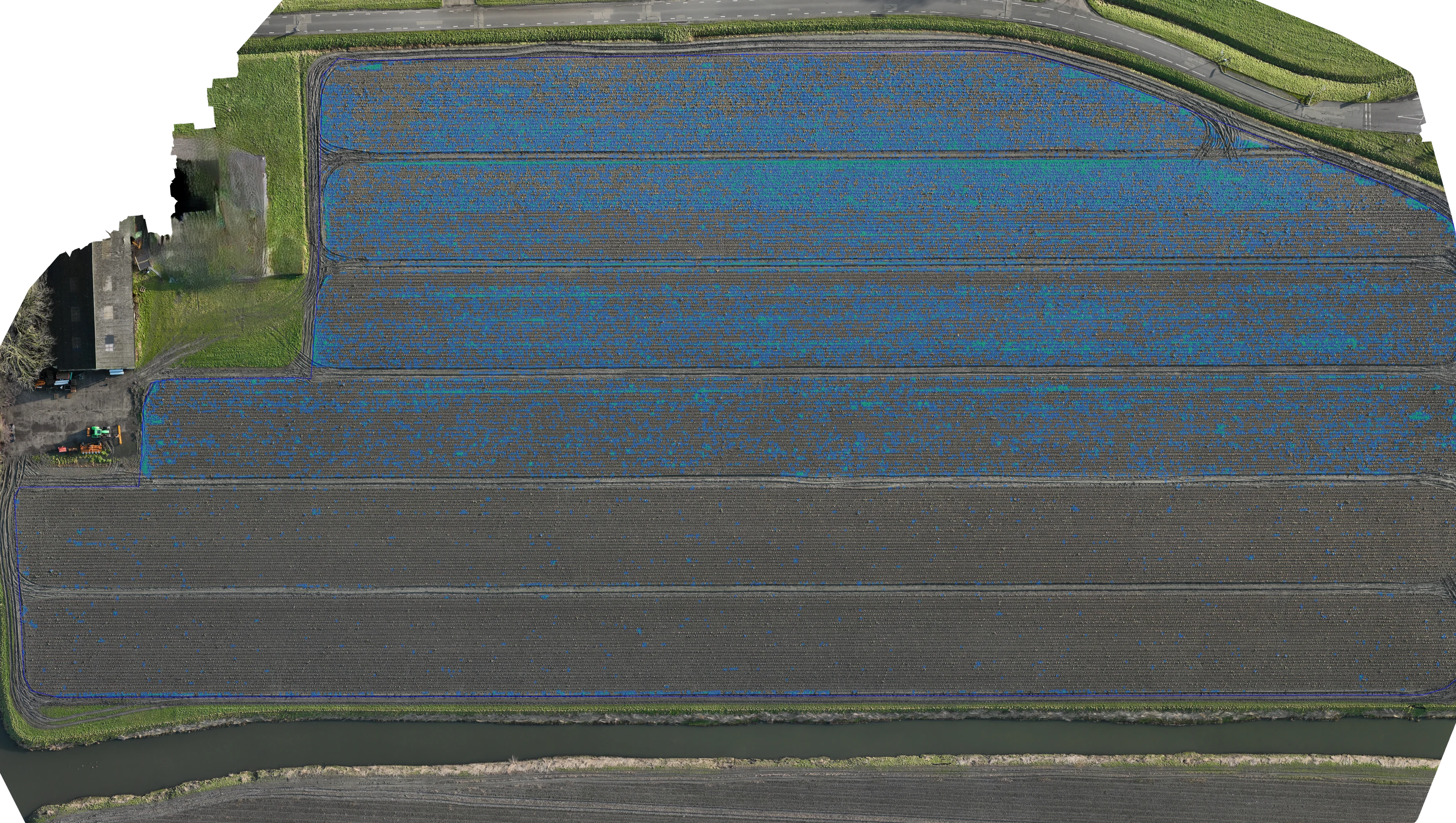
Case Study: Weed Control
73% Reduction in Chemicals
In a recent test on a cauliflower field in Noord-Holland, we mapped the weed pressure in just 5 minutes of flight time. The prescription map was processed automatically in ~1 hour. Instead of the standard 26.8L, we targeted only the weeds, requiring just 6.2L of product. (Note: Application pending due to soil conditions).
Precision is your
License to Operate.
European agriculture is changing. Precision agriculture is the answer to the strict Water Framework Directive (KRW 2027) and makes Green Deal targets verifiable. Simply spraying or fertilising isn't enough; you need to prove precision.
Proven 50-90% savings on inputs
Automated prescription maps save you 50-90% on fertiliser and crop protection. Your crop needs, precisely mapped.
Ready for KRW 2027
We prepare you for the 2027 Water Framework Directive (KRW). Your application data is exported automatically; on request we already compile the full compliance report for you today, so you're audit-ready ahead of 2027.
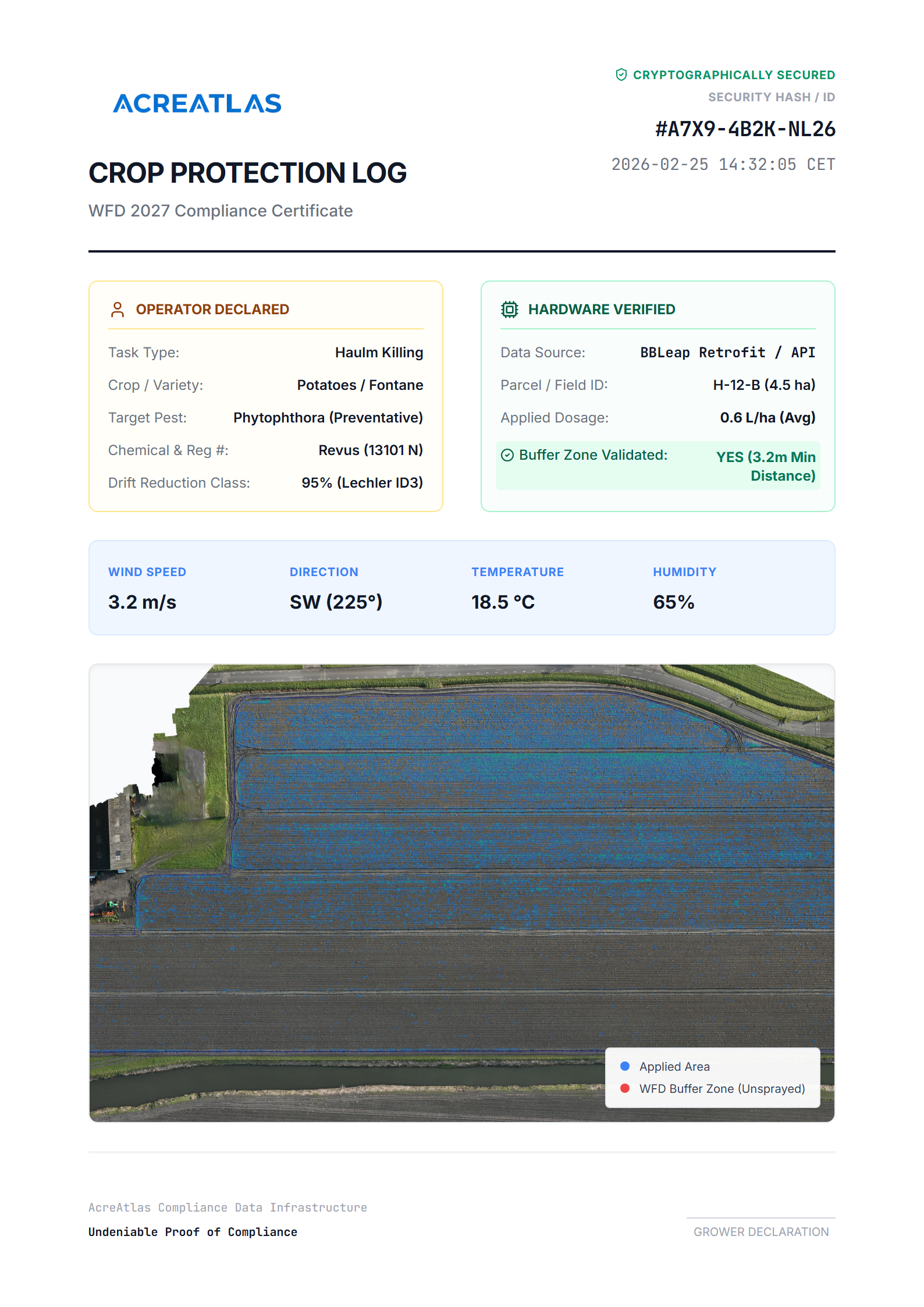
Example KRW report (on request)
Simple Pricing. One Platform, All Tools Included.
Every plan includes the full platform. Pick the one that matches your farm size; pricing scales with hectares, not features.
14-day demo period on every subscription
Every plan includes
- Variable rate spraying
- Parcel boundary registration
- Broccoli detection
- Access to new use cases as they launch
Growth
50 – 150 ha
For mid-sized farms processing multiple fields or flights every season.
Start 14-day demoCustom
250+ ha
Built for service providers, advisors and very large farms. We tailor a quote to your operation.
Request a quoteFrequently Asked Questions
Stop Guessing.
Start Precision Agriculture.
We are currently onboarding select partners for the 2026 season.
Or email us directly at info@acreatlas.eu
No pilot? No problem!
For a limited amount of farmers that sign up, we will come and fly your first mission and support the workflow. (Someone will contact you to check sprayer compatibility). Terms and conditions apply.